Wednesday, October 24, 2012

The Wide View

Graduate students capturing images of the native grasslands
How often, on an absolutely perfect autumn day, do you have to spend the day outside as part of your job?  I know I rarely have that good fortune, but the stars were aligned on Monday, October 22.  That day, I escorted thirteen Rutgers University landscape architecture graduate students and their two advisers on a tour of the Pennypack Creek watershed.  The students' studio project this term is to develop a master plan for a watershed in central New Jersey.  The advisers were aware that the Pennypack  watershed has a long history of fairly sophisticated land use planning, natural resource conservation, and ecological restoration, so they brought the students to southeastern Pennsylvania to get a feeling for what can be done if government entities, nonprofit organizations, and municipal agencies can work in concert.

The upper third of the watershed has largely been given over to standard suburban development; much of it is already a "lost cause."  So, instead of starting at the source of the creek, we began the tour at the Pennypack Preserve in the central portion of the watershed and worked our way downstream over the course of the day.

After touring a portion of the protected land in the Pennypack Preserve and reviewing the forest restoration and native grassland creation projects underway, we enjoyed a picnic lunch then headed south into the city of Philadelphia for an overview of the lower third of the watershed.  Within the city, the creek flows through Pennypack Park, a protected corridor of parkland, but the corridor only protects the steep slopes directly alongside the stream, not the creek's tributaries.  Outside the park, development crowds right up to the edge of the woods.

Seasonal marsh occupying the site of a former parking lot
Our first stop in the city was at Verree Road where the road crossed the creek.  There, the park district had constructed a wet weather marsh a few years ago on the site of a former parking lot.  The parking lot was only usable part of the year because it was frequently flooded--either by stormwater overflowing from the adjacent creek, or from runoff in the watershed.  The park district scooped out the parking lot and replaced it with a seasonally-wet marsh.  The basin was dry on the day of our visit.

Residential stormwater outfall restoration project
Our second stop was at a stormwater outfall draining a large, mostly paved residential neighborhood in the Fox Chase section of the city.  The park district had recently completed an engineered restoration of the stream channel, replacing a severely eroded 12-foot-deep gully with a wider, boulder-lined swale designed to accommodate the stormwater outfall.  Further downstream, the park had installed a series of check dams and step pools to further slow and attenuate the flow before the stream re-entered its natural channel.  The engineered intrusion into the forest looks raw and unnatural, but the outfall becomes a raging torrent during heavy rains--like a water cannon blasting the streambanks--so anything less than a major retrofit would soon have washed away.

Check dams and step pools in the stream valley
Our third stop was at Frankford Avenue at the fall line--the line at which a stream "falls" off the hard edge of the continent (often at a waterfall or rapids) and flows out onto the unconsolidated sediments of the coastal plain.  The fall line also represents the landward limit of the tides; downstream of this point, Pennypack Creek becomes tidal.

Rapids at Pennypack Creek's fall line
Students at the fall line, with the Frankford Avenue (King's Road)  bridge in the background
Just a few hundred feet downstream of the fall line, the creek is spanned by the oldest bridge in the United States--the King's Road bridge, built in 1697.  The King's Road connected Philadelphia with New York.  The bridge (now known as the Frankford Avenue bridge) is still in use and bears a heavy load of vehicular traffic.

Our final stop of the day was on the coastal plain at the mouth of the creek at Pennypack on the Delaware.  Here, the creek adds its flow to the Delaware River, which is also tidal.  We arrived at low tide, and the mud flats flanking the mouth of the creek were fully exposed.  The wetlands around the mouth of the creek are home to a pair of Bald Eagles, which started building a nest two years ago and have fledged chicks successfully each summer since.

Mud flats exposed at Pennypack Creek's mouth at the Delaware River
The Philadelphia skyline, about seven miles distant
Students spread out in the maze of trails near the mouth of the creek to explore its wetlands.  As I came around a corner of a paved walking path, I found two students sprawled on the asphalt, clearly intent on something in the center of the trail.

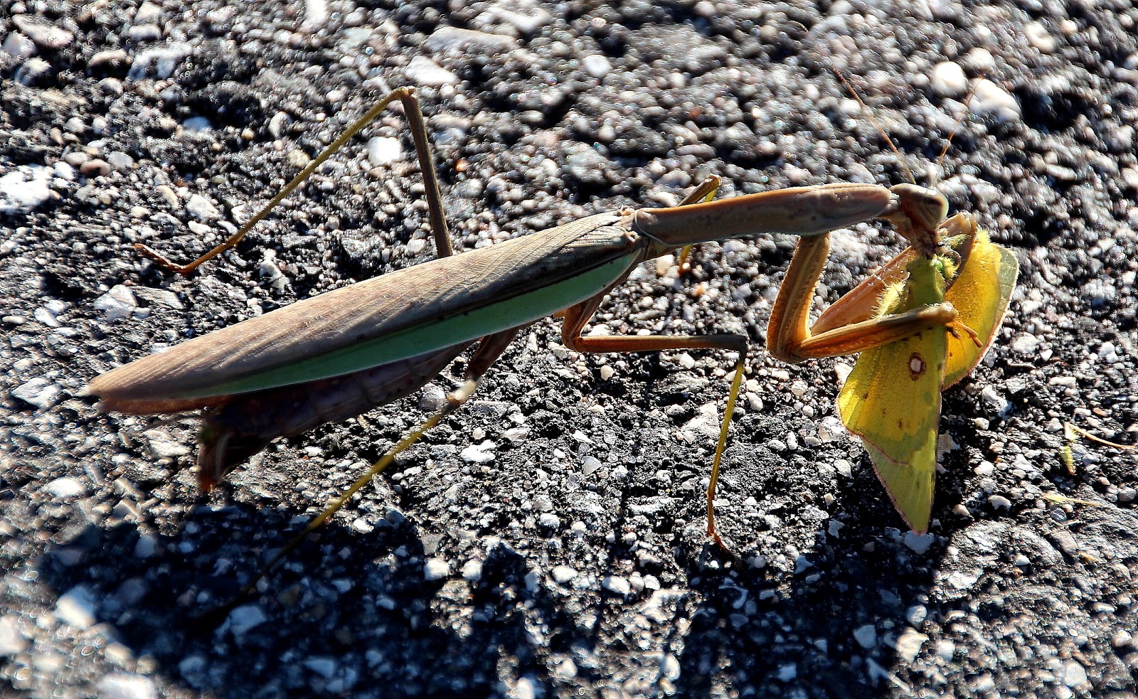
A really hard day, or something exciting...?

They were getting up close and personal with a preying mantis that had caught a sulfur butterfly and was making quick work of the victim.


After we returned to our vehicles, I sent the students back to New Brunswick, New Jersey, and I headed back to the 'burbs.  A good day was had by all.

Submitted by 
David Robertson, Executive Director

No comments:

Post a Comment